
Written and Photos by Jim Butler
The Deep River
The Deep River is a tributary of the Cape Fear River, approximately 125 miles long. The river is habitat to two federally-endangered species, the Cape Fear shiner, a critically endangered minnow, and the Atlantic Pigtoe, an endangered mussel. The Rocky River enters the Deep River at the White Pines Nature Preserve. The Deep River joins the Haw River at Mermaid Point near Moncure to form the Cape Fear River.
Iron and coal deposits along the Deep River in Chatham and Lee Counties were known to early settlers in the 1700s. Plans were made to exploit these deposits using locks and dams to make the river navigable down to the Cape Fear and on to the coast. The minerals proved to be difficult to extract in quantity, and making the river navigable so far upstream was beyond the resources available. Ruins of locks, dams, and furnaces can still be seen on the river.
Trip Background
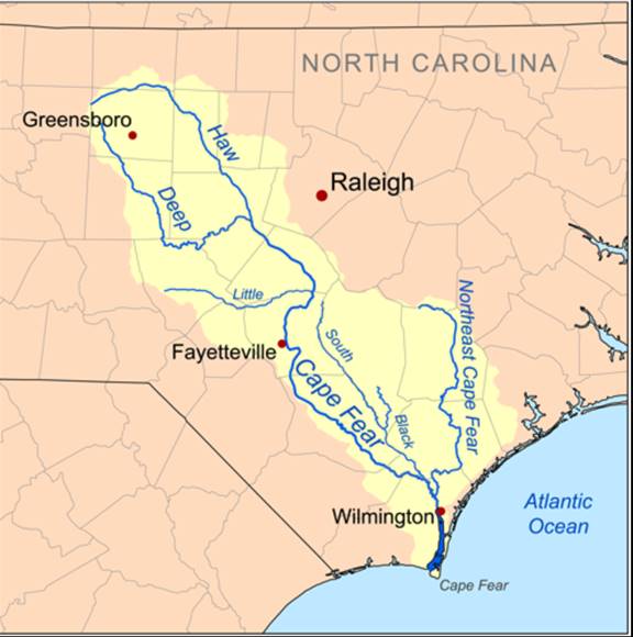
I paddled section 6 (10.5 miles – page 75 in Paddling Eastern North Carolina by Paul Ferguson) five years ago in the middle of the summer with my younger son Matthew. There were significant challenges with both the put-in and take-out, probably the toughest of any trip I have done in NC. Five years ago we chose to use ropes (see below) at the NC 22 bridge which is not a put-in approach mentioned in PENC. The brush was too thick at the time to use either of the suggested put-in approaches mentioned in PENC. At the take-out there is a 70-foot-high bank of riprap that you must climb to get to the road (see below).
put-in

take-out
My older son John was staying in Durham in November so I thought it might be fun to try this same stretch 5 years later. There has been very little rainfall this fall in NC but in many spots in the Deep River the water level is “always at minimum”. The suggested water gauge for this trip is 30 miles upstream so we figured we would just drive over an eyeball the water level and take our chances.
Trip Report
John and I spent considerable time scouting the put-in and take-out options. For put-in options PENC says “At the NC 22 bridge, guardrails prevent parking on the right side of the river. Upstream left of the bridge, Deep River Mill’s gate is closed to traffic, but paddlers have been permitted to carry boats the quarter mile between the upstream dam and the gate. It is possible to take out downstream left of NC 22 off River Road but the bank drops abruptly and there is no path. It is a thicket of briars and bushes. A narrow channel between the bank and a long island carries outflow from the hydroelectric plant.”
John and I parked on River Road and walked over the NC 22 bridge to the downstream right side of the river.
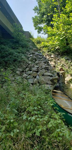
Nice view of the river and the dam that is upstream.
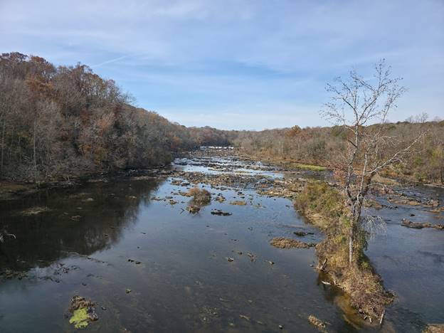
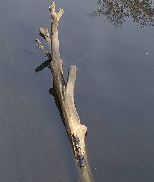
Downstream view of the river from the bridge. It is hard to see but there are 4 turtles sunning themselves on the log and on the right there is the foundation of an old bridge.
The possible put-in at the bridge (see below) hasn’t gotten any easier than it was 5 years ago. John and I figured there must be an easier way.
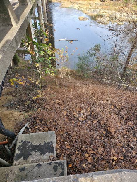
Getting to the main branch of the river from River Road was going to be a very tough slog as you can see below. Our cars are in the background of the picture. We were looking at having to cross a mixture of briars, swampy marsh and small streams before we could start paddling.

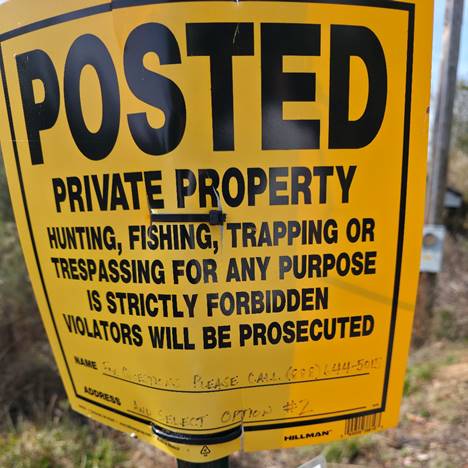
That left the Deep River Mills gate put-in option to explore but it didn’t look very inviting. There were several fairly fresh no trespassing signs that seemed rather serious. John and I explored the easy quarter mile path that leads very close to the river. I made a few calls to the numbers listed on the various signs, but I could not reach anyone. After much debate we decided this was our best option. I carried my copy of the PENC book just case we were stopped by any authorities.
Upstream view of the river at the put-in spot.
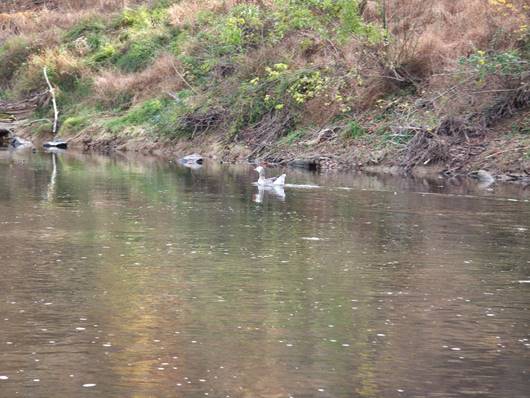
In the first mile we saw some snow geese.
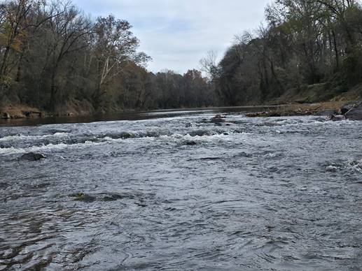
PENC describes section 7 as having banks that often rise to over 100 feet and many long islands split the river into channels. There are more than a dozen small rapids scattered down this section. The first half of the trip has ten rapids, with a few reaching Class II-.
This was the first small rapids just downstream of the bridge and the put-in spot.

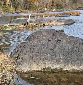
Woolly Bear Caterpillars were out in numbers on many of the rocks along the river. Woolly Bear are fuzzy larvae known for their distinct black bands at the ends and a reddish-brown band in the middle, often seen migrating in fall seeking hibernation spots, linked to folklore about predicting winter severity (more black = harsher winter), though science attributes color variation to age and moisture, not weather prediction.

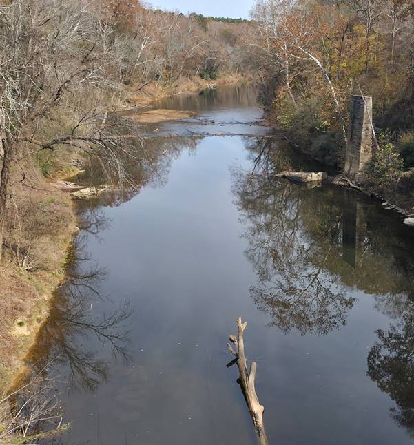
One of the many Class I rapids further downstream.
The weather was sunny and warm for a mid-November day. The trees still had a bit of color.

The take-out spot at the Glendon-Carthage Road bridge hasn’t changed and it is still challenging.

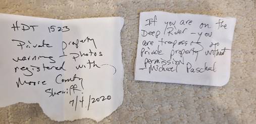
When I parked next to the Glendon-Carthage Road bridge 5 years ago I got a note on my windshield (see below). To avoid the same fate this time I parked a quarter mile away on a side road but got the same result (see below).
Trip Summary
This is a great stretch of river if you don’t mind challenges at the put-in and take-out. There are frequent small rapids which keep it fun. For 10 miles we only saw a couple of houses and a handful of people. The scenery is breathtaking. I highly recommend this section of the Deep River but be sure to allow plenty of time for scouting both the put-in and take-out spots.
Appendix – Trip Information and Resources
The best resource for any eastern NC river excursion is Paddling Eastern North Carolina (PENC) by Paul Ferguson.

Details on sections 6 (pages 75-76) from the book are:
- Difficulty – I -II-
- Width – 60-500 feet
- Distance 10.5 miles
- Gradient – 4.1 feet/mile
- Scenery – A – little to no development
The suggested minimum for section 6 of the Deep River is 1.1 feet. The gauge is 30 miles upstream and water takes half a day to reach the put-in. During our trip, the water level was just below minimum, but we had to get out of the canoe only a handful of times.
.
We paddled hard but our pace averaged only 3 miles an hour. We frequently had to scout where the clearest path was and much of the time we were zigzagging down the river to catch the deeper parts.
After the trip I called a few of the numbers on the “no trespassing” signs. I called 1-888-6445015 #2 and spoke with Stephen Colomb who is Deputy General Counsel at Resource Environmental Solutions LLC that is in charge of the Deep River Mill’s gate.
He said paddlers are absolutely NOT allowed to use the gate and path. He said they have been having a lot of trouble with paddlers using their property and he is not happy. So cross the gate from the list of options for the put-in for this section. You’ll have to use ropes at the bridge or slog across from River Road.
The gray dot is where we parked at the put-in. Easy parking by the side of the road.
When I got back I looked up a phone number for Michael Paschal. I called him several times and left messages to better understand the parking issue at the take-out bridge but I never heard back. I wrote him a letter to see if we could communicate that way but he hasn’t responded. Until this is resolved keep in mind you might encounter some trouble at the take-out spot.
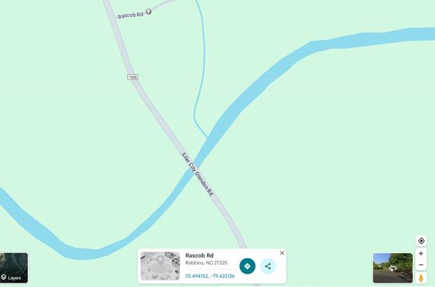
The grey dot is where I parked on Rascob Road on the most recent trip but I still got a note on my windshield.
Jim Butler jimbutler100@hotmail.com 919-314-7357