A Carolina Paddler “Different Waters” Article
Written by Jim Butler
Photography by Jim Butler and Dave Hammond
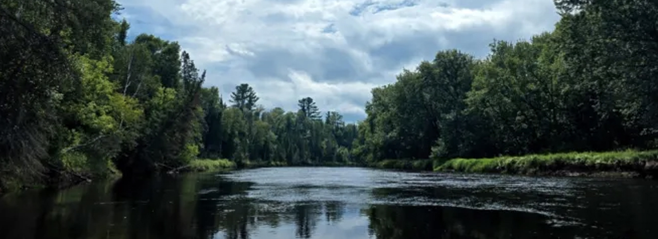
∞ The Mississippi River is the fourth longest river in the world and the largest on the continent, flowing 2,350 miles from Lake Itasca in Minnesota to the Gulf of Mexico. In Minnesota, the river flows through valleys, bluffs, prairies and woodlands in a variety of flow rates and widths. Mississippi means “Great River” in Ojibwe.
Trip Background
Dave Hammond and I were born and raised a block away from each other in Appleton WI. We paddled together in the summer as teenagers and then later in life we became serious about paddling. We focus on doing a weeklong canoe trip every year. Back in 2005, we spent 2 weeks paddling the first 280 miles of the Wisconsin River. We finished the last 140 miles of the Wisconsin River fifteen years later. The trip ended by doing a few miles on the Mississippi River where the Wisconsin River empties into the Mississippi.
Our annual paddle trips are usually in the Midwest. For this year’s trip we tackled one of the most famous rivers in the world, the Mississippi River. Many serious paddlers have fallen asleep dreaming of paddling its entire length of 2,350 miles. At my age, doing the entire length is no longer on my bucket list. Still, Dave and I like to start our trips at a river’s headwaters and so we thought we would do the same with the Mississippi.
The more research we did the more daunting the Mississippi headwaters appeared to be. One paddler who paddled the entire length had this to say about the headwaters: “The Mississippi River at the headwaters is nothing more than a trickling, shallow stream. At the very beginning the river is shallow and narrow, with rocks and fallen trees creating obstacles and hazards. At times you wonder if you’ll ever make it to the Gulf at all. The water is so shallow we had to walk for several miles in the river.”
Mississippi River Days 1-4
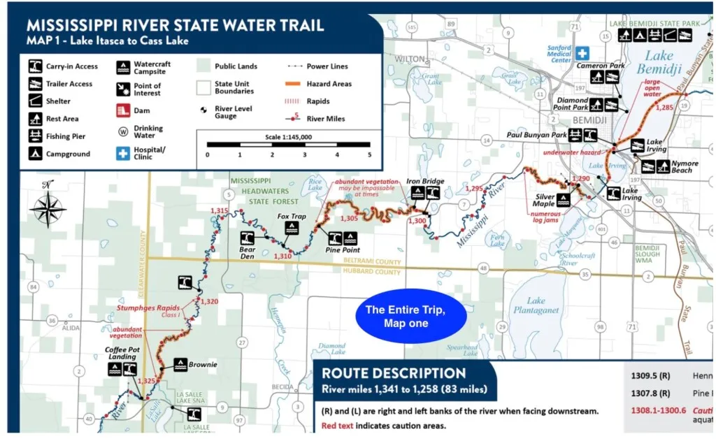
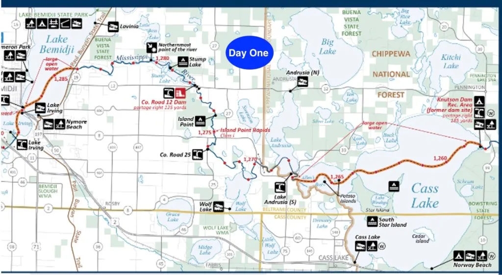
The Mississippi River State Water Trail Map points out several challenges in the first 55 miles including sections of abundant vegetation (may be impassable at times) and numerous logjams. “Wetlands throughout this stretch have dense, maze-like vegetation, which may lead you astray or prove to be an obstacle.” See below:
Dave and I tend to overpack when we do overnight canoe trips, so these conditions were going to pose some challenges. We came up with an alternate plan to camp at nearby campgrounds and do day trips in a light canoe with little gear.
In researching the trip I learned a severe wind event described as a “microburst” or “derecho” struck the Bemidji area in June 2025, causing extensive damage, including an estimated 9 million downed trees across Beltrami County. The storm had implications for our planned trip.
I made calls to the Minnesota Department of Natural Resources asking about conditions. I was put in touch with Dave Schotzko, DNR Parks and Trails Bemidji area supervisor – (218) 308-2367 david.schotzko@state.mn.us . His first question to me was “Do you own a drone?” Well, no. He explained many sections of the headwaters are swampy, and it isn’t clear where the main channel is. A drone is useful in seeing ahead.
Schozko said the only people who paddle the headwaters are “thru-paddlers” who want to say they paddled every mile of the Mississippi. No paddlers have reported they enjoyed the first fifty miles. Learning this, Dave and I decided to start our trip where the Mississippi River exits Lake Bemidji. Dave booked a campsite with lake views at West Winnie Campground.
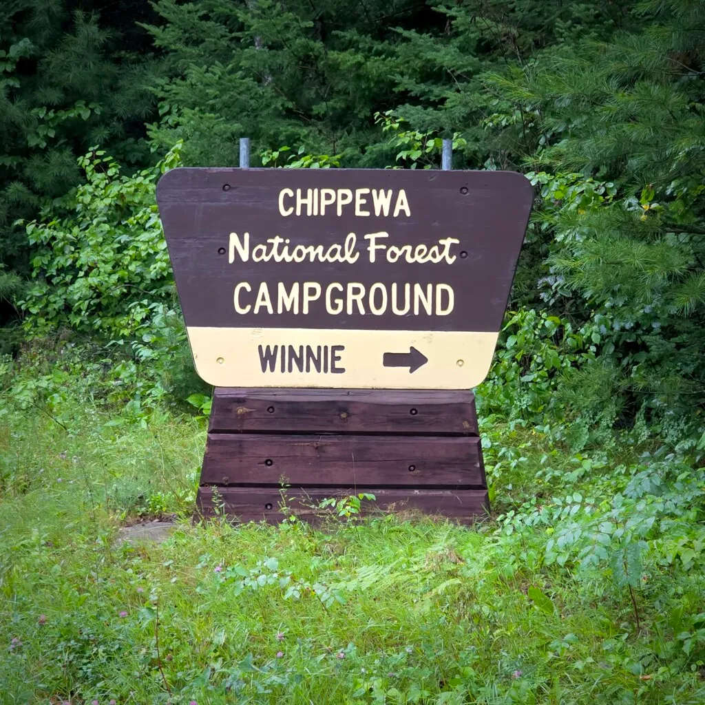
The campground is situated on the western shore of Lake Winnibigoshish (try saying that fast three times in a row) in a scenic forest of mature red and white pine. The location was centrally located for our first three days of paddling. The campsite hostess warned about bears but we didn’t see any during our stay.
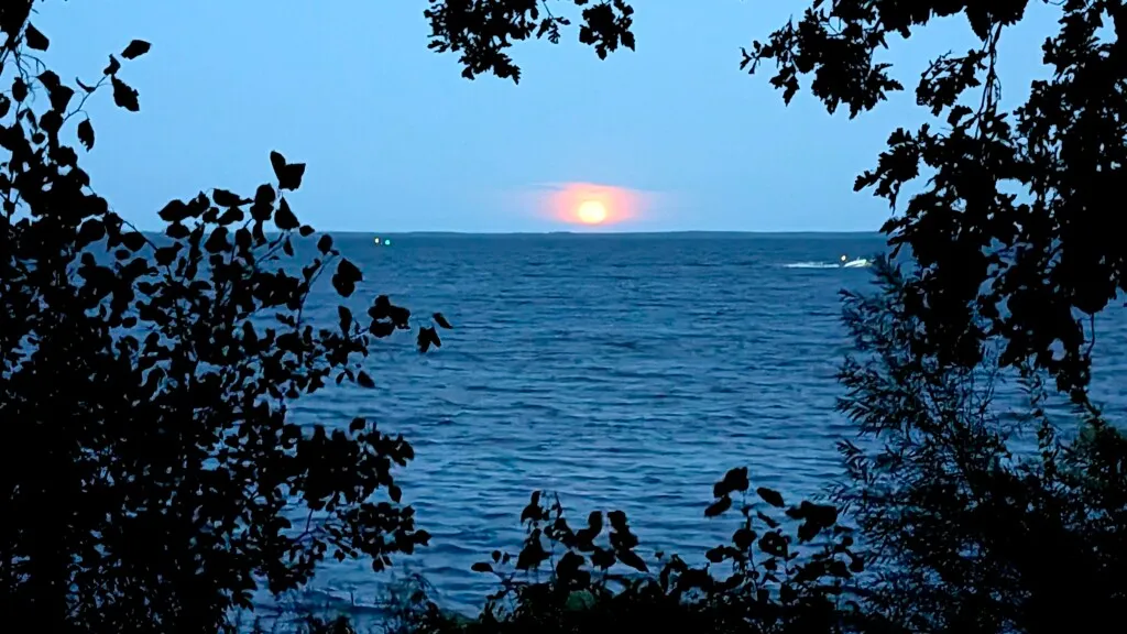
We made camp and had our traditional opening night dinner of Neuske’s brats. Despite the mosquitoes Dave enjoyed a swim while a stunning full moon rose over the lake.

A drawback of not camping along the river is the extra time spent shuttling. Driving around the area, we saw signs of the recent storm damage. A tree had fallen on a house next to the put-in we used.
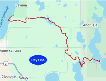
Day One: Lake Bemidji to Lake Andrusia See Maps for each day at the end of the article.
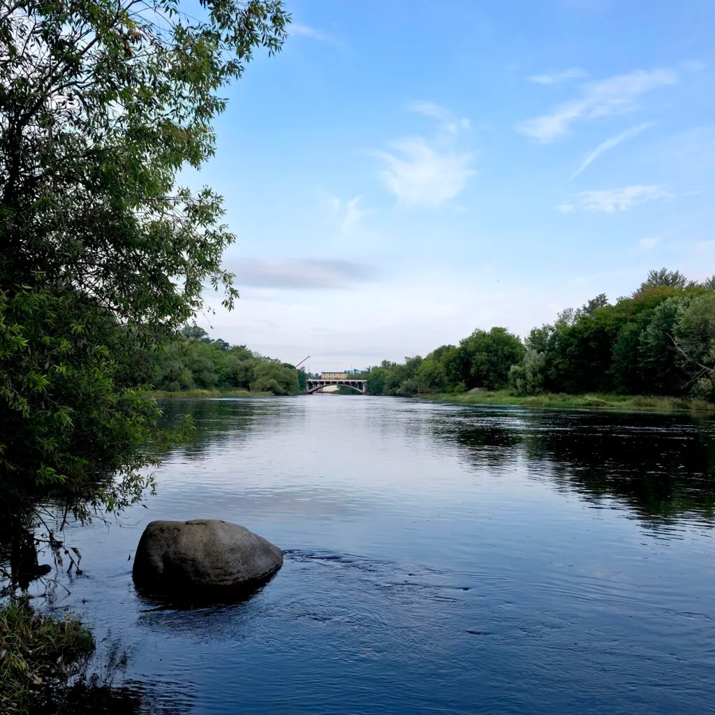
Lake Bemidji is a popular lake with many homes, docks and boats. A pair of large statues of the American folk hero Paul Bunyan and his ox, is located in Bemidji. This pair of statues are said by the Kodak Company to be the “second most photographed statues in the United States”, after Mount Rushmore. We put in and started our river adventure in late morning.

In this stretch the river is wide and the water is very clear. For the first few miles there are homes but quickly it becomes wilderness. A small dam required a short portage.
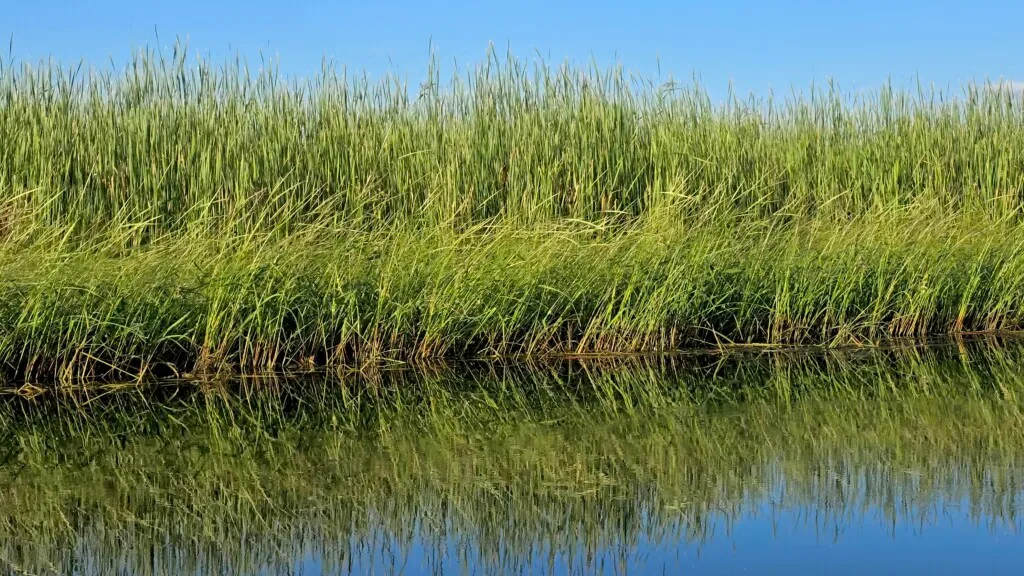
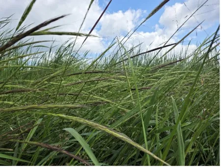
Downstream the river widened and meandered through swampy ground lined with wild rice. Minnesota has more acres of natural wild rice than any other state. Wild rice is an aquatic grass not related to common rice. Early in the summer, the plants bloom with tiny maroon and gold flowers, and by late summer, their seeds mature into dark brown kernels ready for harvesting. In Minnesota the plants can grow to 12 feet.
Dave and I settled into our afternoon routine – steady paddling to cover miles. The scenery didn’t change for hours – endless banks of wild rice, tall reeds and cattails. I was mesmerized until I spotted something odd.
A man and two kids were sitting motionless on a jet ski. The family had motored a half mile up the Mississippi from Wolf Lake when their jet ski stalled. The man phoned his wife with no luck. We tried towing the jet ski and passengers but it was too challenging for our canoe. The man asked us to go to his home to seek help. We gave him our spare paddle to maneuver the jet ski and proceeded to the man’s house. A call must have reached his wife because she met us at their dock. She suggested we use their pontoon boat to retrieve the family. We motored up, meeting the jet skiers paddling downstream. We towed them home, said our goodbyes and continued our journey.

It was a beautiful afternoon and peaceful beyond words. Calm, clear water framed the wild rice as far as the eye could see. We took out an hour later at Lake Andrusia and stopped at the Tavern on South Shore in Bemidji where they did an outstanding job of providing a very average dinner.
Day Two: Knutson’s Dam to West Winnie Campground
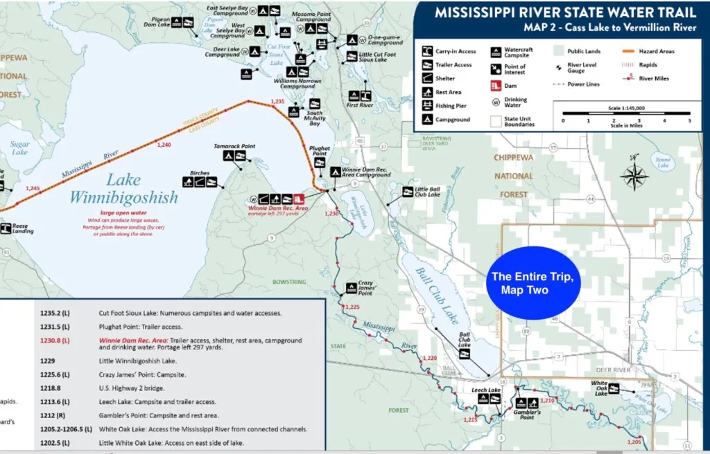
After Lake Andrusia, the Mississippi enters Cass Lake, eight miles across. Paddling across Cass Lake is not recommended due to waves and high wind. We skipped it and put in below Knutson Dam on the eastern shore of Cass Lake, planning to paddle to our campsite thirteen miles away.

We thought the spillway above the put-in was Knutson’s dam. Below the put-in the river turns sharply to the left. Another body of water lay further to our left. We paddled over to check things out and found low boulders covered with gulls.
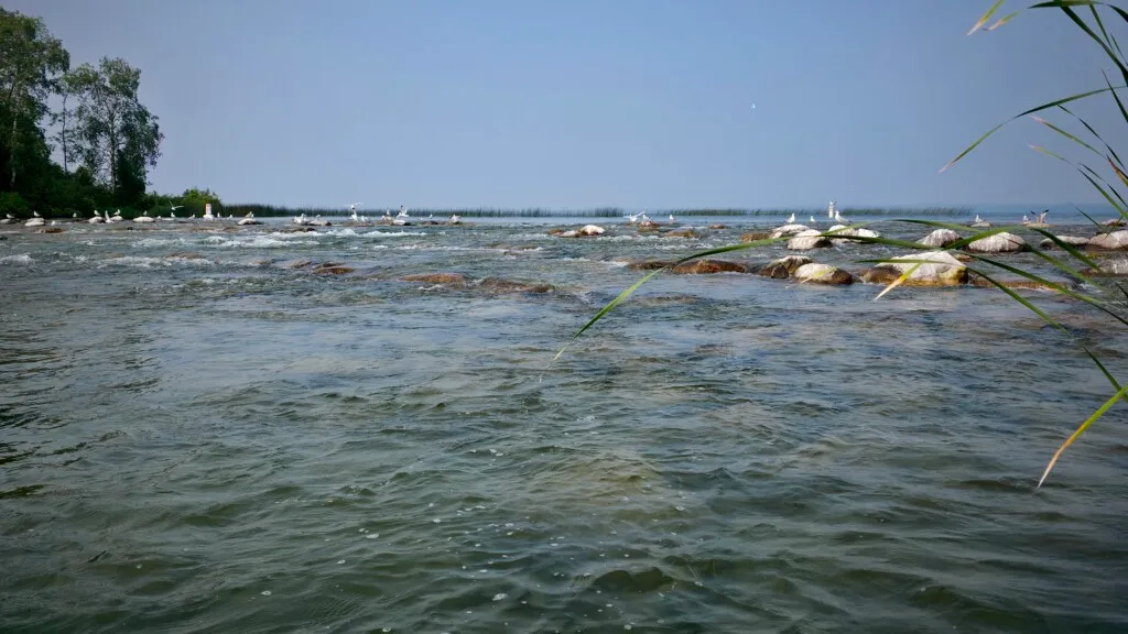
Later research revealed, “Knutson Dam was a dam located along the Upper Mississippi River within the Chippewa National Forest and was originally built in 1890s as a logging dam. In 1928 it was rebuilt by the US Army Corps of Engineers and management of the dam was given to the US Forest Service. The dam was removed and replaced with rock arch rapids in 2015.” So the bird-covered rocks turned out to be the real Knutson’s Dam.
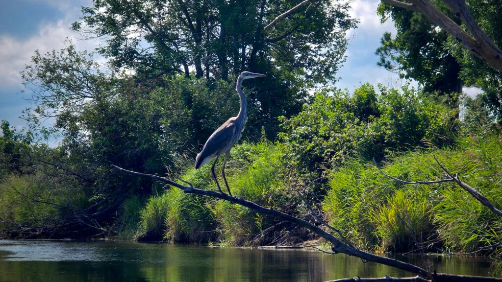
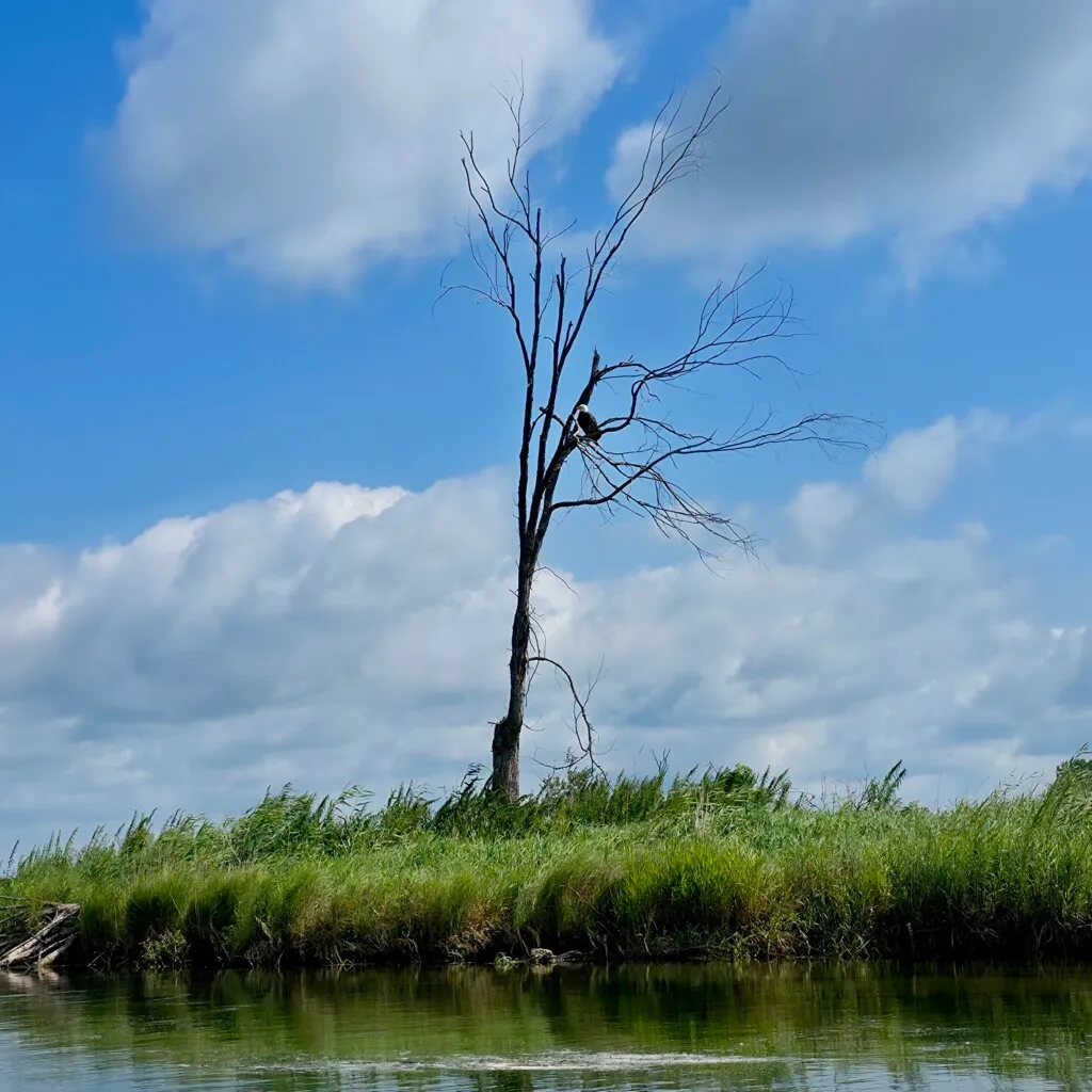
We saw abundant wildlife (deer, herons, and eagles) every day of the trip. A pair of otters frolicked in the river. This stretch of river is called the Mississippi Meadows – an extensive marshy plain which is the bed of an ancient glacial lake.
Bugs – Mosquitos and Flies (horse and deer)
At Winnie Campground and on the river the bugs were as expected for this time of year in Minnesota – meaning your skin needs to be covered and you need to apply bug spray. Dave and I were used to bugs from our previous trips.
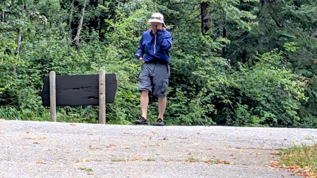
A few times a day we would stop at a riverside campsite to scout and determine if camping on the river would be better than our managed campgrounds. Most river campsites were below average and lacking amenities like a table or rustic toilet. Any time we set foot on shore we were besieged with swarms of mosquitoes and flies, even at the boat landings. HereI I am swatting at bugs at a landing. Each venture on land resulted in numerous bites. Once back in the canoe, the dozens of bugs would only dissipate after 15-20 minutes on the water.
Joseph Nicollet, an early explorer of the headwaters, wrote in 1836, “The mosquitoes were so fierce and turned out in such great numbers that by 10 o’clock I had to abandon the battlefield to them, having accomplished but a part of what I intended to do and that much at the expense of serious inflammation of my eyes and face caused by their bites”. Henry Schoolcraft, an early explorer of the Mississippi headwaters in the 1820s wrote, “Our visit was of peculiar privation, fatigue and physical suffering. Not the least among these have been the calls of an unsatisfied appetite, stings of mosquitoes, and the incessant motion of travelling, depriving us due rest at night.”
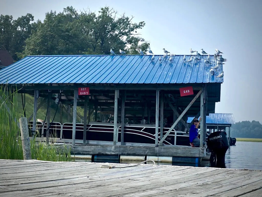
I spotted an establishment on the shore and suggested we make a stop. Dave responded, “We have to do it,” and we paddled over to The Four Seasons Resort. The gulls were particularly fond of the spot on the boat shelter closest to the water.
We asked the shelter attendant (the owner’s son) what services were available at the resort. He said a place offered craft beers, and then kindly led the way to the Lodge. There we had the pleasure of meeting Ty Triebenbach, the new owner of the Four Seasons Resort.
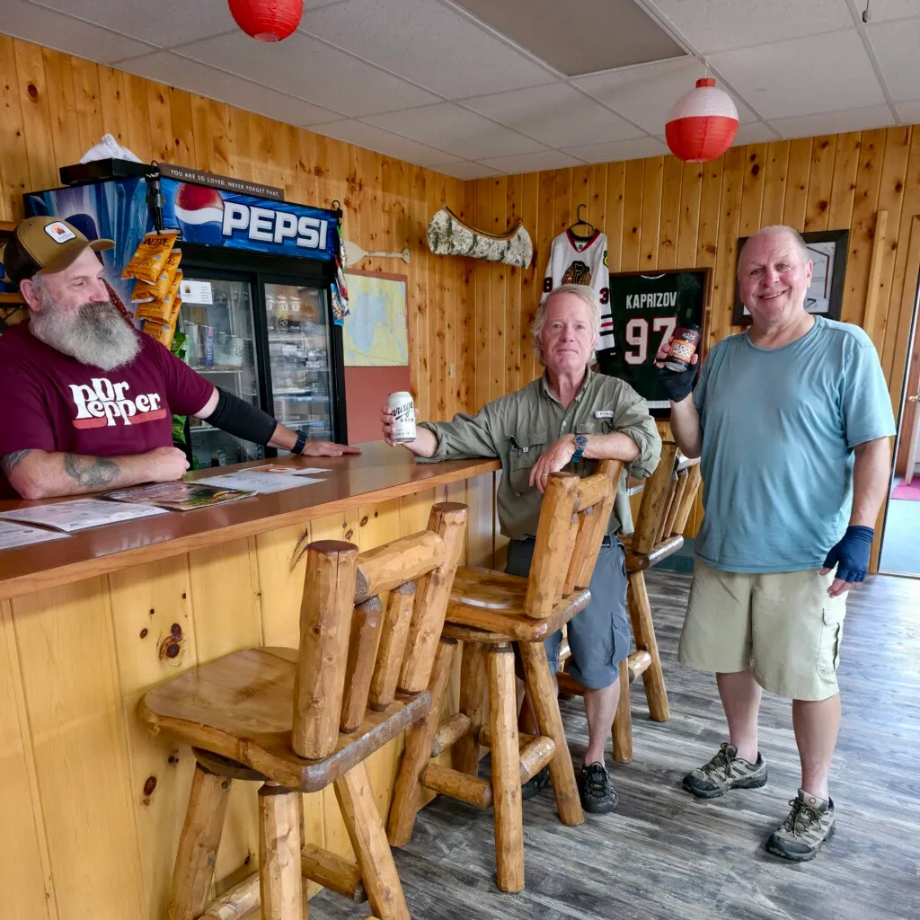
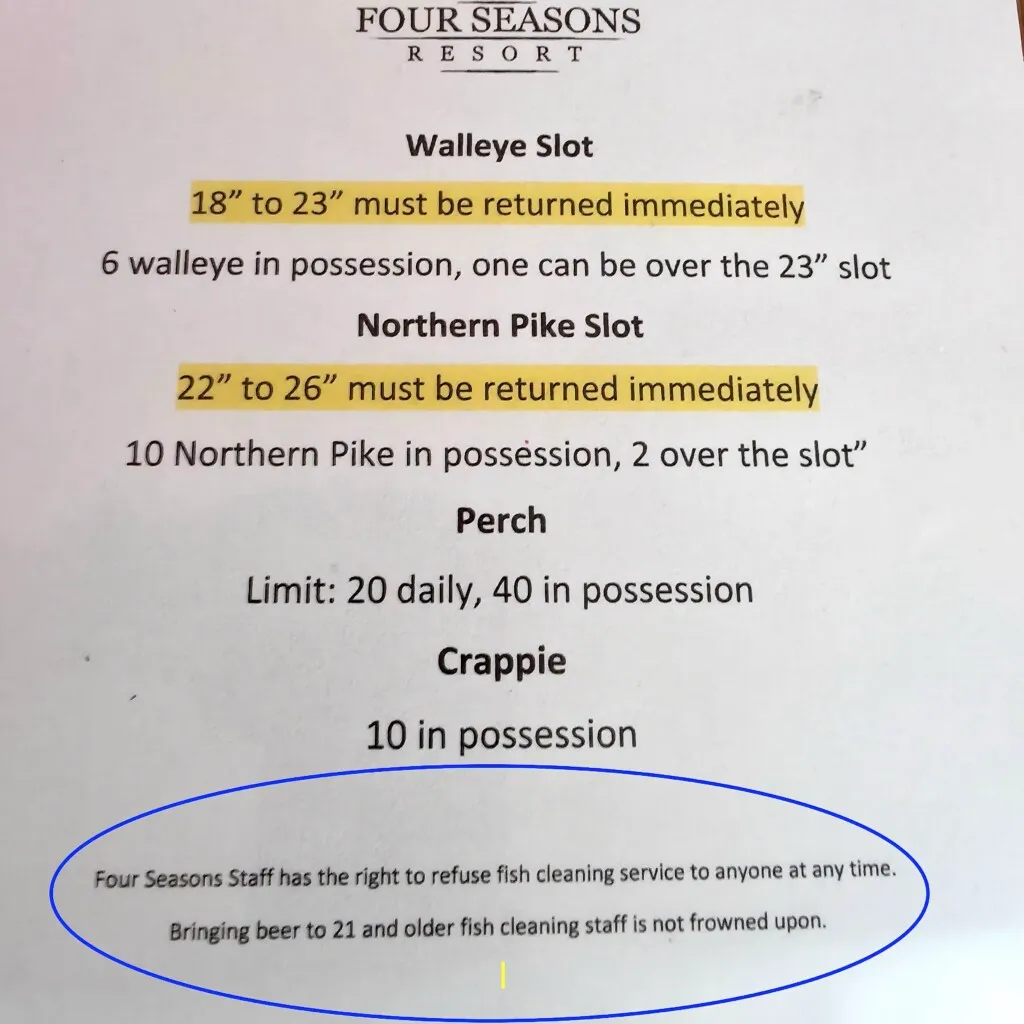
It was our first Blue Highways moment of the trip. Blue Highways is a term for “a chance meeting of a colorful local with no shortage of stories.” We enjoyed our beer while Ty explained the tipping policy on fish cleaning. See the last line in the sign below. The fish cleaning staff was his adult son.
We could have settled in but we limited ourselves to one beer. Back on the water, we paddled a mile and took out right at our campsite.
In the summer of 2025, Minnesota experienced significant impact from wildfire smoke drifting south from Canada, leading to haze, poor air quality, and health alerts across the state. The smoke originated from numerous large wildfires in Canadian provinces of Alberta, Saskatchewan, and Manitoba, with the most intense plumes causing “very unhealthy” air quality levels. The haze varied considerably from day to day.
Day Three: Lake Winnibigoshish Dam to Leech Lake River
Lake Winnibigoshish is the 4th largest lake in Minnesota and is eleven miles wide. Like Cass Lake, paddling across Lake Winnibigoshish is not recommended because of wind and waves. Our plan was to put in at the east shore of Lake Winnie and paddle fifteen miles to Leech Lake.
In the morning, we drove an hour to Schoolcraft State Park where we booked a campsite online for the remaining 3 nights. Mature red and white pines dominate the park, including a pine tree that is estimated to be more than 300 years old.
We put on in late morning after changing campgrounds. I caught a very nice rock bass below the dam.
For most of this stretch the river was wide, there was little current and no breeze. We paddled at a relaxed pace with only 15 miles to cover. Actually, Dave paddled while I fished. Although Dave and I have spent a dozen weeks together in a canoe, we never seem to run out of stories and never let facts get in the way of a good story.
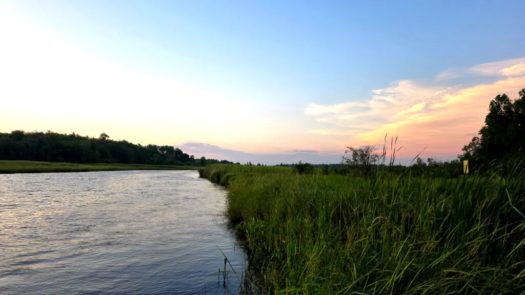
We took out where the Leech Lake River meets the Mississippi River, rewarded with incredible sunset views.
After a few minutes of swatting bugs back at our campsite, we opted to drive to Gosh Dam Place bar/restaurant in nearby Deer River. Gosh Dam Place is 65 years old and is known for “daily homemade soups, our chicken wild rice soup, the Big Winnie Burger, duck wontons and our famous homemade pizza.” Dave and I chose the fish fry which was outstanding as was the service.
Day 4: Morning segment, Leech Lake River to Schoolcraft State Park campground
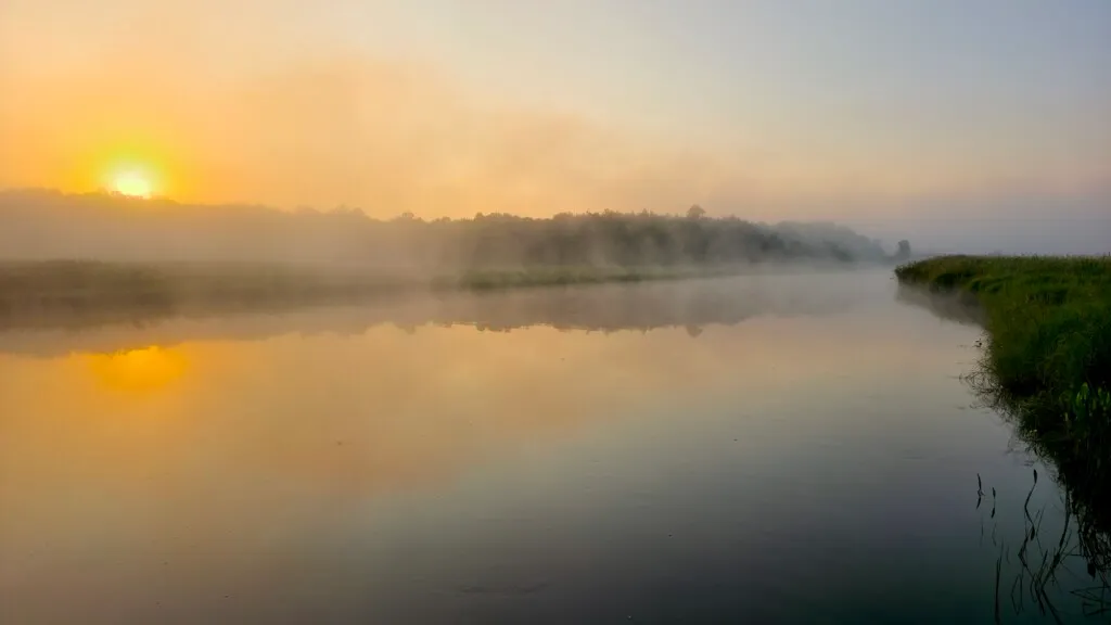
We had beautiful sunrises each morning at this campsite, often with mist coming off the water as the sun rises.
We started early with only cereal bars and coffee for breakfast. The day’s paddle was Leech Lake River back to our campsite so shuttling was simple.
The river was wide with little current. The accommodating wind was at our back. The scenery remained consistent, mostly swampy meadow banks with a border of wild rice and then cattails for as far as the eye could see. There was more wild rice along the river’s edge than I have ever seen.
With little dry land and the risk of being devoured by mosquitoes, we skipped lunch. We arrived at our campsite by midday and drove back to Gosh Dam Place to sample their world famous pizza.
Day 4 Afternoon – Schoolcraft State Park campground to #10 Access
After lunch we retired to our tents for a nap. Afterwards we decided to paddle four miles from our campsite to Access #10. It was very leisurely paddle and I spent much of my time fishing with little to show for it.
Great way to spend an evening. Weather was perfect with a clear sky.
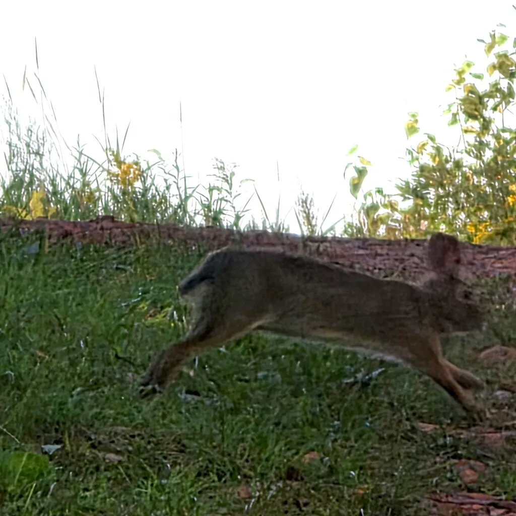
A rabbit greeted us at the take-out. We had our lunch sandwiches for dinner and called it an early night.
Day 5 – Grand Rapids Library to County Road 72 Trailer Access
The next fifteen miles of the Mississippi are flat and slow moving with two dams needing to be portaged. One dam controls the level of Lake Pokegama and the other provides hydropower to the Blandin Paper Company. We decided to skip this section of the river and put in at a park right below the Blandin Paper Company dam in the city of Grand Rapids. Grand Rapids has a population of 11,126. The city is named for the 3.5-mile long rapids in the river which was the uppermost limit of practical steamboattravel during the late 19th century. Today the rapids are hidden below the Blandin Paper Company dam. Notable people from Grand Rapids include Judy Garland and Hugh Beaumont(Ward Cleaver) from the television show, Leave It To Beaver.
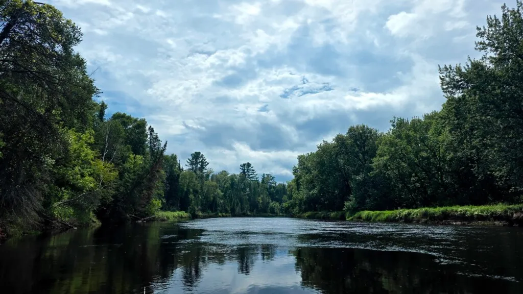
This section of the river is one of transition, from the wetlands and forests of the Chippewa National to the lowland hardwood forest including hills built from glacial debris. The river enters an ancient glacial lakebed where it twists back and forth through the soft soil. There are lots of white and red pines, oaks, maples, birches and aspens that create a home for diverse wildlife.
We jogged (see the appendix if you are unfamiliar with this term) cars and got on the water at 9am. The put-in had signs about special musky regulations. Musky (muskellunge) are large Northwoods fish so I was looking forward to an exciting day of fishing. A stiff headwind greeted us. The riverscape changed with the forest coming down to the water’s edge and the water dark with a sandy bottom.
I made some casts and as I was reeling in a bass something large made a splash nearby. I assume it was a musky going after the bass. It was the closest we would come to seeing a musky on the trip. The fishing, after this excitement, went cold. With few houses or development, it was great looking fishing water but with little results.
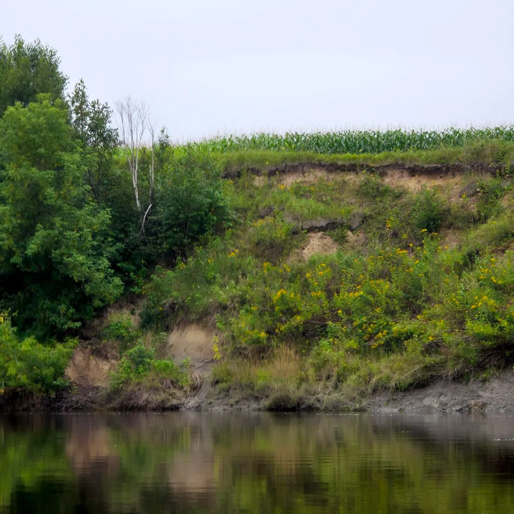
We started seeing sandbars and had lunch on one the mosquitoes had somehow overlooked. There was a cattle field nearby and high bluffs along much of this section.
We took out at the County Road 72 Trailer Access after 17 miles and decided to stop for a cold one at The Tied, a dive bar in Grand Rapids. The bar at The Tied is made of wood from pickle barrels. Francis Gumm, aka Judy Garland, got her start in a theater operating in the basement of the building. The Tied sells more Hamms beer than any other bar in Minnesota but we demonstrated great discipline and limited ourselves to one beer.
Fishing Report
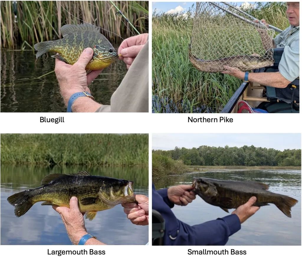
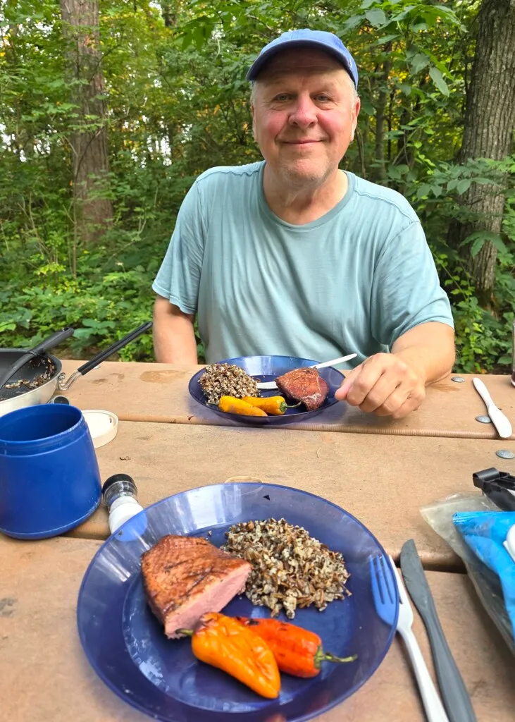
The plan for this trip was to have a more relaxed pace than normal, allowing me to fish. We always hope for one meal of freshly caught fish on each trip. Despite much of the river looking productive, I only found one or two hot spots each day. Below are some of the fish caught.
I kept filets from a perch, rock bass and bass. We decided to brave the bugs and have a final dinner of fish, bacon and home fried potatoes.

Dave and I have very different personalities which tend to complement each other on these trips. He is more conservative and often the voice of reason. I am more aggressive in pushing the limits. As Paul Ferguson says in Paddling Eastern North Carolina, “In a group, it is rare when everyone agrees a particular camping site is the best choice.” When Dave and I do overnight trips, he is suggesting places to camp by 5pm while I am ready to settle on a spot as the sun is starting to set. We balance each other and never have any unpleasantness about the final campsite decision.
For this trip, we didn’t worry about finding campsites since we were staying at campgrounds. We did need to sort out plans for our final day. We both wanted to start driving back by midafternoon. When planning the trip, I calculated on our last day we would need another 10-20 miles to complete 100 miles. On a planning call I threw out the idea that 100 miles would be a satisfying goal. The conversation went something like this:
Jim: “I was thinking that we could knock down one hundred miles on this trip.”
Dave: “I was thinking we could enjoy the paddle and let our bodies dictate our progress.”
Jim: “Sure, we can do that. But I think we could still get 100.”
Dave: “I’m not sure those two ideas are compatible.”
Jim and Dave: “Laughter”
During the week there was little chatter about a goal for our final day, partly because we both wanted to see how energetic we were as the trip wound down. One option was no paddling on Friday. Just pack up and drive home and celebrate a wonderful trip.
While Dave was cooking dinner, I mentioned we needed 16 miles on Friday to make the 100- mile goal. It would mean a hard morning of paddling since we wanted to be off the water by early afternoon. I left it at that while Dave finished cooking. After dinner I saw Dave pull out the maps and start to pour over them. He said he was game for a morning of stout paddling. The challenge was finding a 16 mile stretch we could easily do. There are few access points along the Mississippi River in this area. Dave found an 18-mile segment that fit conveniently into our plans. I volunteered to leave my fishing gear in camp. Dave’s jaw dropped. We have never paddled together when I didn’t have my fishing gear. We agreed and called it a night.
Day 6 – Herb Beer’s Access to County Line Access
Up early, we packed our gear and drove to Herb Beer’s Access, a few miles upstream from the previous day’s takeout. By 9AM we were steady paddling. This is another area with high sandy bluffs.

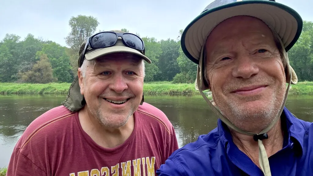
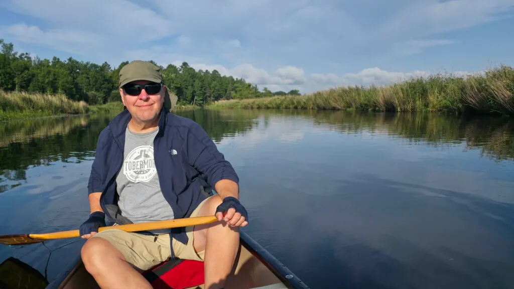
After 4 ½ hours of paddling, we were off the river by early afternoon, having covered 18 miles. We celebrated with a final photo at the takeout.
Our goals for the trip were met. Staying at campgrounds instead of the riverbank was the right choice. Although we didn’t begin our trip at the exact start of the river, we had a satisfying Mississippi headwaters experience. We expected to see numerous paddlers during our travels on this famous river but in six days we never saw another person with a paddle in their hands.
The weather was perfect. We had a shower one night but only wore raingear for a brief time the last day. This section of the Mississippi River is well protected from development. 90% of the miles we paddled were what Paul Ferguson would rate as an “A” for Scenery: Little to no development is evident from the river. Except for a rare bridge or house, the river appears to be in a remote area.
Our itinerary was a great way to experience the headwaters of the Mississippi and avoid huge, windy lakes or difficult dry sections. Consider this a Mississippi Headwaters Highlights Tour
. If your schedule is flexible, do this trip in the spring or fall when the bugs are not as plentiful. I plan to come back and try wild rice harvesting. A great spot to spend a week on the water.
Appendix One: Daily trip maps
Day 1 – Sunday August 10, 2025
Lake Bemidji to Lake Andrusia – 19.25 miles, 7 hours
Day 2 – Monday August 11, 2025
Knutson’s Dam to West Winnie Campground (left side of map below) – 13.67 miles


Day 3 – Tuesday August 12, 2025
Lake Winnibigoshish Dam to Leech Lake River – 15.48 miles


Day 4 AM – Wednesday August 13, 2025
AM segment Leech Lake River to Schoolcraft State Park campground – 14.8 miles


Day 4 PM – Wednesday August 13, 2025
PM segment – Schoolcraft State Park campground to #10 Access – 4.19 miles

Day 5 – Thursday August 14, 2025
Grand Rapids Library to County Road 72 Trailer Access – 16.81 miles


Day 6 – Friday August 15, 2025
Herb Beer’s Access to County Line Access – 18.20 miles


Appendix Two: Trip Information and Resources
Winnie Campground https://www.recreation.gov/camping/campgrounds/233144
Neuske’s brats (https://www.nueskes.com)
Mississippi River State Water Trail https://www.dnr.state.mn.us/watertrails/mississippiriver/index.html
A Thru Paddlers Guide to the Mississippi River https://www.intothewideopen.com/?page_id=3714
Dave Schotzko, MN DNR Parks and Trails Bemidji area supervisor – (218) 308-2367 david.schotzko@state.mn.us
Jogging To “jog cars” between two spots on a river refers to the logistics of getting vehicles from a launch site (the “put-in”) to the end point of the trip (the “takeout”).
While the term “jogging” isn’t a standard part of the paddling lexicon, it accurately describes the back-and-forth process, or shuttle, that paddlers use to move vehicles. The process works like this:
- A group meets with at least two cars.
- They all drive to the “takeout” point where they will end their paddle.
- One car is left at the take-out.
- Everyone gets into the other car, along with all their paddling gear, and drives to the “put-in” point upriver.
- The group then paddles the river to the take-out point, where their second car is waiting.
- They can then load their gear into the second car and drive everyone back upriver to retrieve the first vehicle.